

Our Technology
Hardware Infrastructure
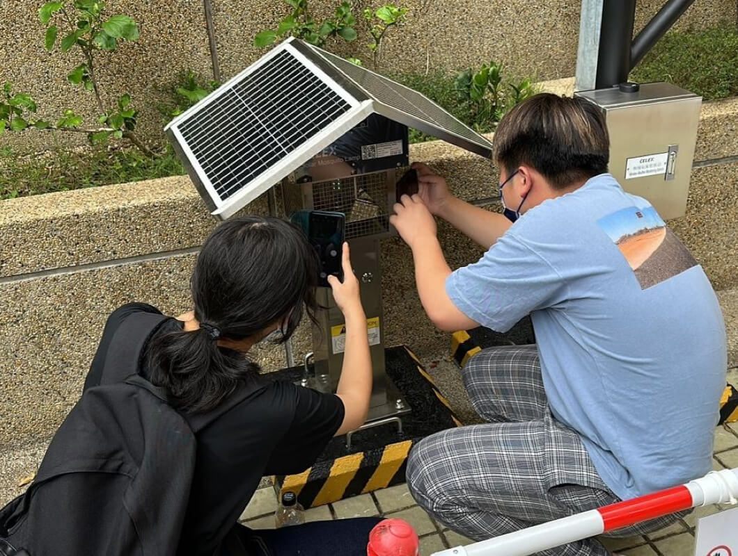
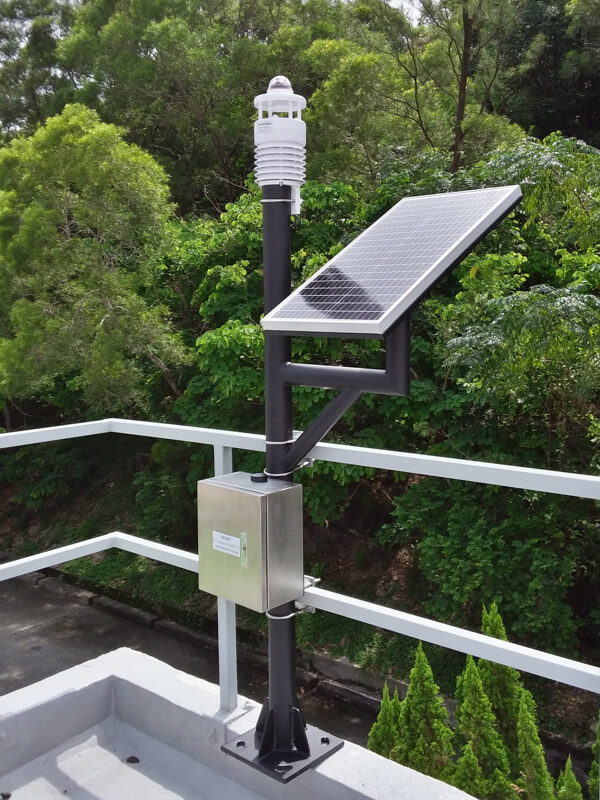
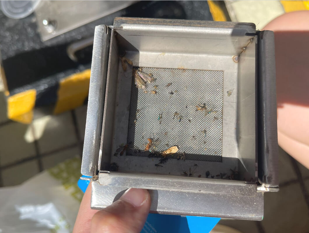
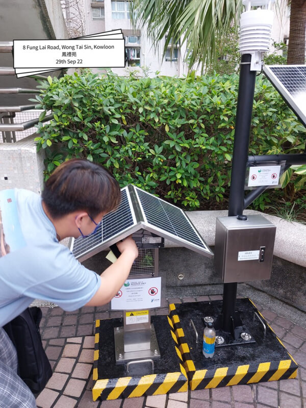
Intelligent mosquito killer lamps and wireless intelligent weather stations are installed in strategic locations to gather information on the weather and mosquito populations. The solar-powered intelligent mosquito killer lamps equipped with sensors that can monitor the number of mosquitoes captured. Wireless intelligent weather stations are used to gather information on various meteorological variables such as air temperature, relative humidity, wind profile and precipitation. The collected data would be utilized to train and fit the GeoAI models that would be employed to generate the mosquito risk index (MRI) and the mosquito risk map.
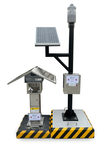
- Solar Panel External Charger
- Intelligent Power Display
- Intelligent Digital Killer Counter for Geographical Analysis
- Energy Saving LED Light Source
- Insects Protection Mesh
- Easily Replaceable Battery
- Solar Panel External Charger
- Built-in Lithium Type Battery
- Stainless Steel Pole for Extreme Climate
- Wireless Capabilities (LoRa network)
Power Consumption
Both the intelligent mosquito killer lamps and the wireless intelligent weather stations include solar panels. In general, a few hours of indirect sunlight on the solar panel would be sufficient to support a week of operation with no interruption. The need for replacing the battery or charging would be minimal.
However, the hardware could also be designed with an add-on battery option, which will further enhance the sustainability of the hardware in any location known to have very low sunlight exposure. The IoT and software platform will also monitor the power level of the hardware. Warnings will be issued if the battery level is consistently low.

Analysis & Modeling
All the data collected from the hardware IoT devices, together with other environmental and historical data, is used to perform exploratory analyses of all independent variables, assessing all independent variables spatially and temporally, fitting several Geo-AI models to the meteorological and environmental variables, and utilizing these models to develop a Mosquito Risk Index (MRI) for the prediction of mosquito abundance.
Input
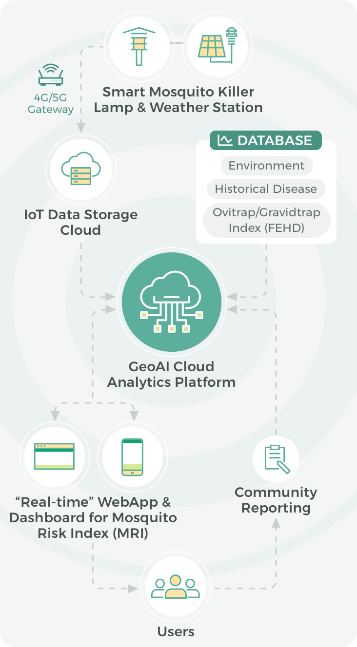
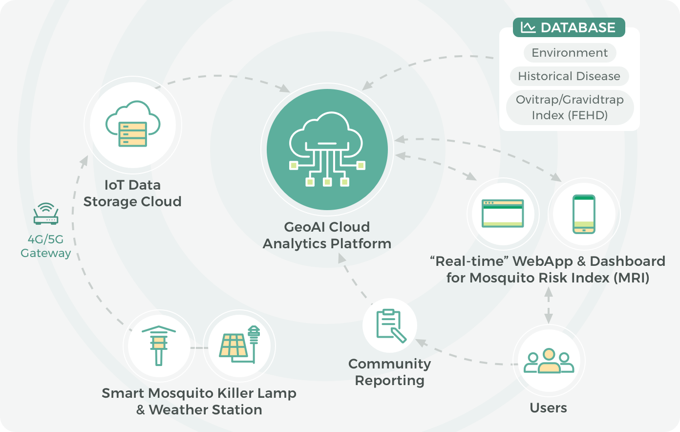
The intelligent mosquito killer lamps and intelligent weather stations installed at strategic locations are utilized to monitor mosquito populations and the surrounding environment. The intelligent weather station collects meteorological data such as air temperature, relative humidity, wind speed, wind direction, precipitation, etc.
Transmission
A 4G/5G gateway integrated into the IoT hardware transmits the collected data to the IoT data storage cloud, allowing for real-time monitoring and data transfer from the field to the database.
GeoAI Application
GIS and AI technologies are used to compile and analyze all the IoT-collected data alongside other big data, for example, environmental data, historical disease data, and the Ovitrap/Gravitrap Index. Various spatial statistical models and AI models are employed to examine the relationship between the dependent and the predicting factors and develop a Mosquito Risk Index (MRI).
Output
The ultimate goal is to create a real-time webapp and dashboard that can interactively display a map-based mosquito risk index (MRI) for Hong Kong and help the general public identify mosquito hotspots as well as be alert to the spread of mosquito-borne diseases.